Where the Thu Bồn begins and where it ends
The Thu Bồn rises high in the Trường Sơn Range — the spine of mountains that forms Vietnam's western border with Laos — and flows east-northeast for roughly 205 kilometres before emptying into the South China Sea at Cửa Đại, on the coast immediately east of Hội An. Along the way it gathers two major tributaries, the Sông Vu Gia from the north and the Sông Cái from the south, and drains a basin of approximately 10,350 square kilometres across Quảng Nam Province.
At Hội An the river broadens into a slow, brackish estuary laced with islands — Cẩm Nam, Cẩm Kim, the Cẩm Thanh nipa palm forest. This is where the river meets the tide, where the water turns from green to brown to blue depending on the rains and the season, and where the geography of the Old Town was set 600 years ago.
600 years as an international trading port
Long before the Vietnamese arrived in this part of the coast, the Champa Kingdom controlled it. Between the 2nd and 15th centuries Cham merchants used the Thu Bồn as a commercial artery, sailing upriver with cinnamon, eaglewood, and ivory from the highlands and downriver to the port of Đại Chiêm — the Cham name for the settlement that would become Hội An. My Sơn, the Cham Hindu temple complex 40 kilometres upstream, was built within reach of the river by design: it connected the kingdom's spiritual capital to the trading world. UNESCO inscribed both sites in 1999, recognising them as two ends of the same waterway.
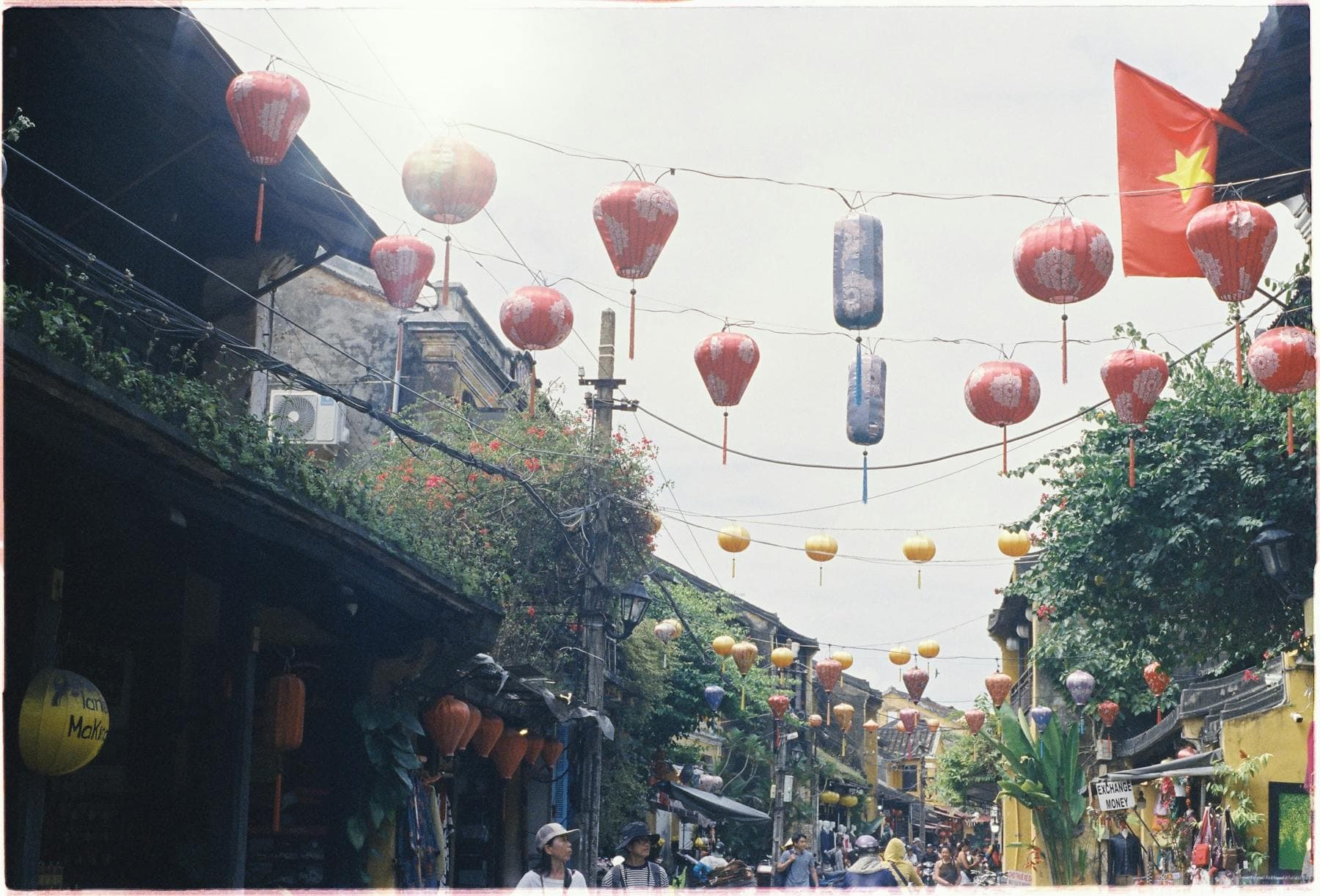
By the 16th century, with the Vietnamese now the dominant power in central Annam, Hội An had become one of Southeast Asia's busiest international ports. Japanese, Chinese, Dutch, and Portuguese trading houses kept warehouses within a few hundred metres of the river. Silk from Tonkin, ceramics from Jingdezhen, spices from the highlands, and silver from Japan changed hands in the same streets — Trần Phú, Nguyễn Thái Học, Bạch Đằng — that visitors walk today. The Japanese Covered Bridge, built around 1593, connected the Japanese and Chinese merchant quarters across a small inlet of the Thu Bồn. It is on every 20,000-đồng banknote in circulation.
How the river built — and then saved — Hội An
In the late 18th century the Thu Bồn began to silt up. Alluvium from upstream deforestation and shifting monsoon patterns reduced the depth at the river mouth, and the ocean-going vessels of the 19th century could no longer enter the harbour. International commerce moved 30 kilometres north to Đà Nẵng, which had a deeper bay, and Hội An was left behind. Its decline as a port turned out to be its preservation: there was no money to demolish the wooden merchant houses and replace them with concrete, no industry to bomb during the wars of the 20th century, and no reason for the modern Vietnamese economy to expand into the Old Town.
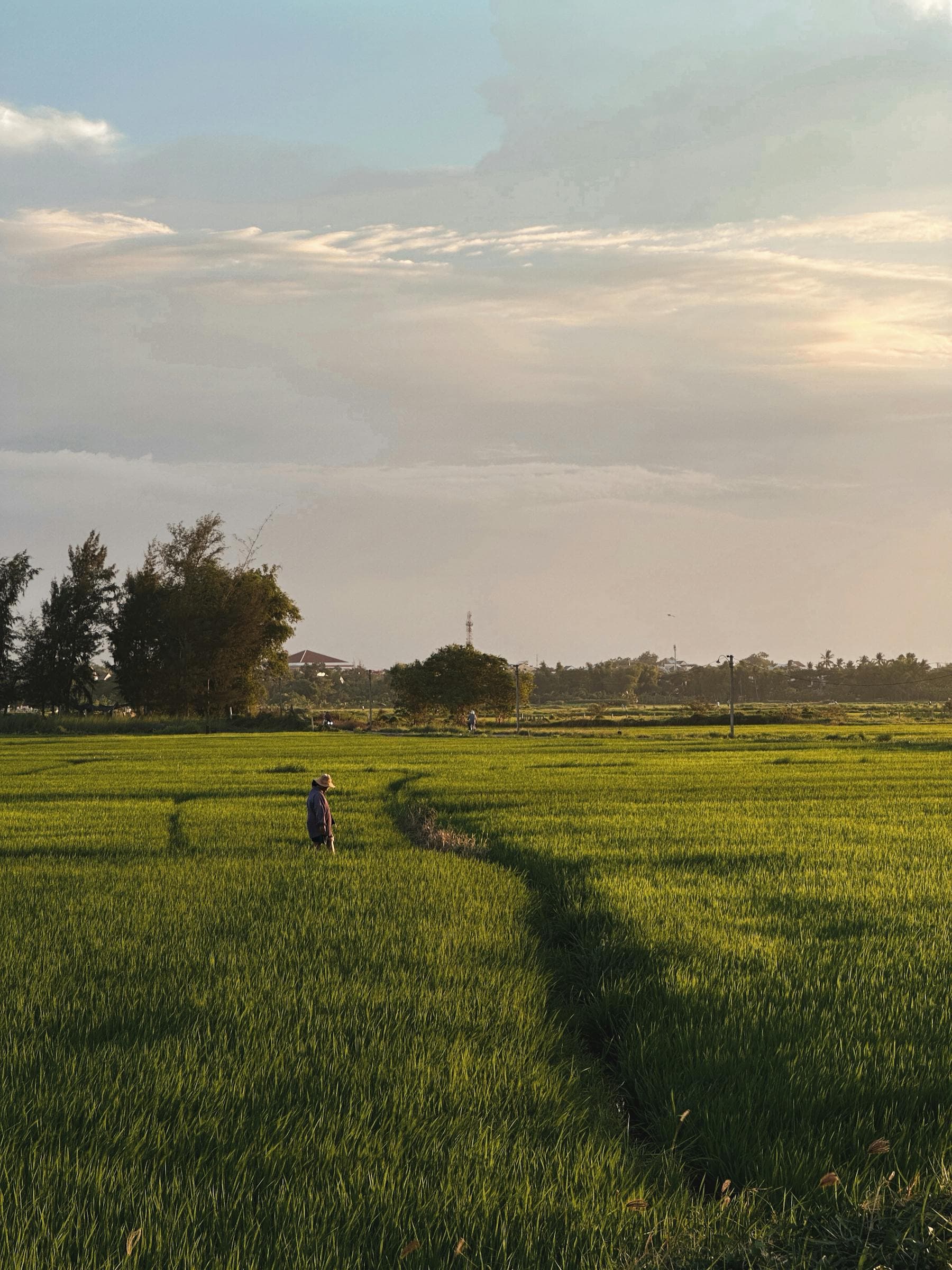
When UNESCO inscribed Hội An in 1999, the citation noted precisely this: that the town was "an exceptionally well-preserved example of a Southeast Asian trading port from the 15th to 19th century." The Thu Bồn made that preservation possible. The same silt that ruined the trade also created the fertile flood plains that today produce Quảng Nam's vegetables, herbs, and rice — the raw materials of cao lầu, mì Quảng, white-rose dumplings, and the cuisine for which Hội An is now equally famous.
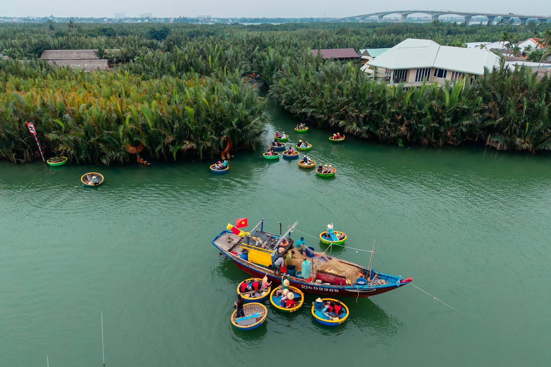
The river today: basket boats, fishermen, lanterns, sunsets
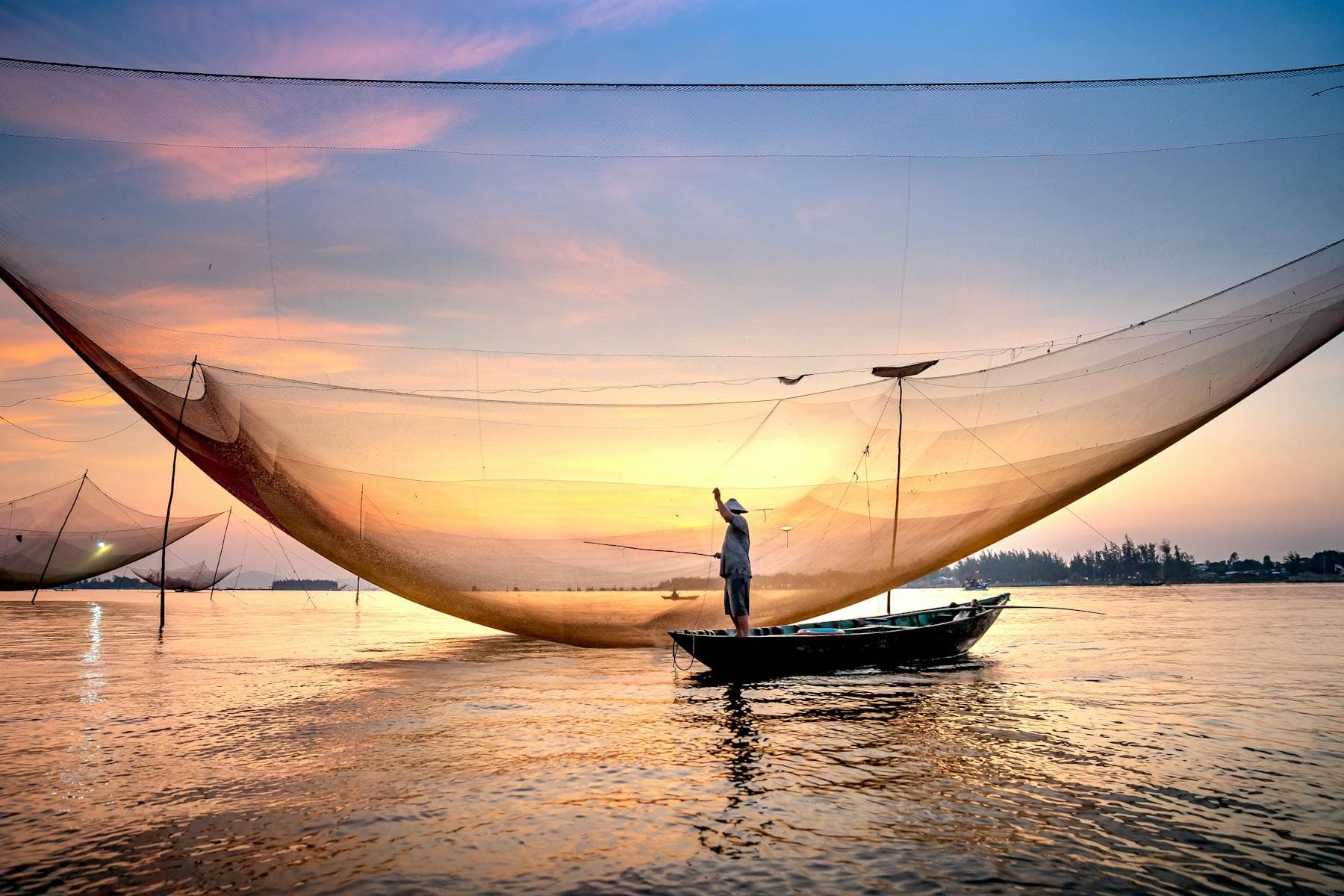
Wake at first light on the Thu Bồn and you will see the river as locals know it. Before dawn, fishermen in circular bamboo basket boats (thuyền thúng) cast nets in the same currents their grandfathers worked. Women paddle flat-bottomed sampans to the morning markets with baskets of water spinach and river herbs. Buffalo wade at the shallows opposite Cẩm Kim Island. By 09:00 the basket boats are back at the village jetties; by 10:00 the river is glassy and warm.
In the late afternoon the river softens. From 16:00 onward, cafes along Bạch Đằng street fill with travellers waiting for sunset. The Cẩm Nam bridge, the An Hội footbridge, and the Bạch Đằng quay all face west across the water — the river's bend at Hội An is one of the few places on the central Vietnamese coast where you can watch the sun set directly into the water rather than behind a hill. We publish a live sunset countdown for Hội An at /sunset, calculated from Jean Meeus's Astronomical Algorithms to ±30 seconds.
The Lantern Festival on the Thu Bồn
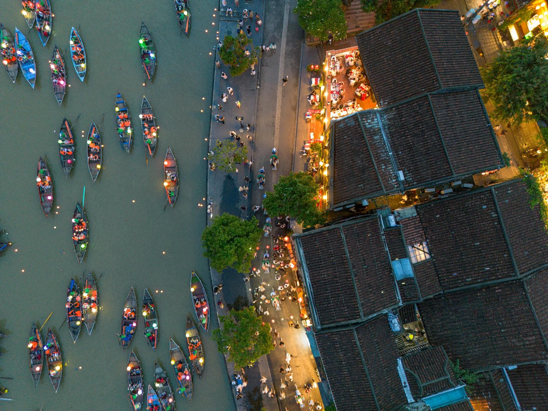
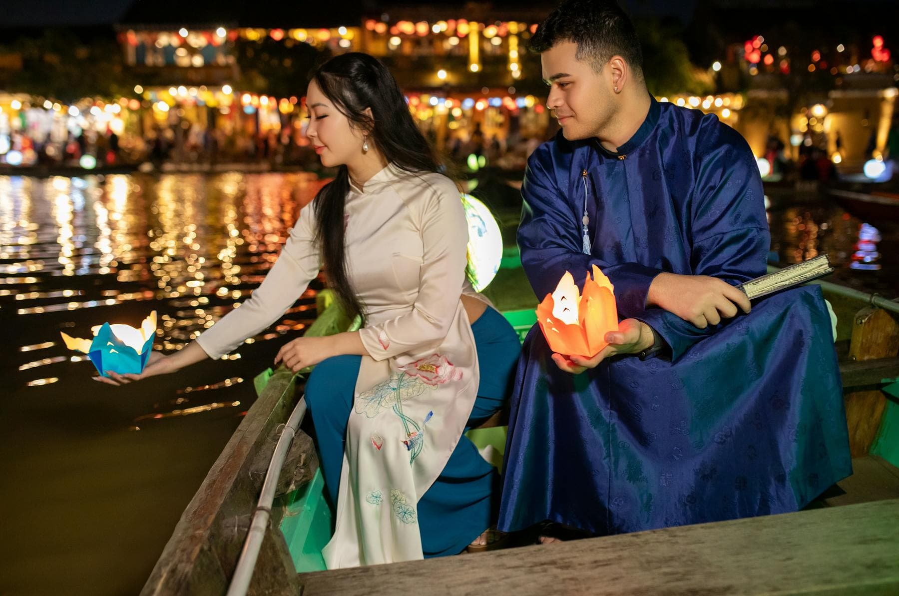
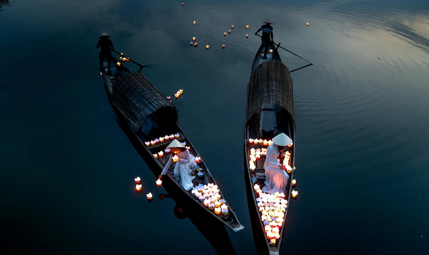
Once a month, on the 14th day of the lunar calendar — the night before each full moon — the Ancient Town turns off its electric streetlights and the Thu Bồn fills with paper lanterns. The festival is called Đêm Rằm Phố Cổ ("Old Town Full-Moon Night"). Vendors sell paper-and-candle floats at the An Hội footbridge and along Bạch Đằng for 20,000 đồng per three; visitors walk down to the water, light the candle inside, and push the lantern out into the current. By 19:30 the river surface is a slow procession of orange and red flames moving toward the sea. We maintain a 12-month Hội An lantern festival calendar with the upcoming Đêm Rằm dates.
Important geographic note: the lantern festival is concentrated in a 400-metre stretch of river directly in front of the Old Town, between the An Hội footbridge and the Cẩm Nam bridge. Upstream of the Cẩm Nam bridge — the stretch past Cẩm Nam Island where the south-bank residential riverside hotels sit — the river stays dark and quiet on festival nights. This is part of why the south bank is the preferred sleep side of Hội An.
Sunset spots on the Thu Bồn (ranked)
Six named viewing locations along the river, in order of popularity (not necessarily quality):
- Cẩm Nam Bridge. Pedestrian-friendly bridge across the river south of the Ancient Town. Best 20 minutes before sunset; the lanterns light on the north bank as the sun drops.
- An Hội footbridge. The yellow-lit pedestrian bridge inside the Ancient Town. Most photographed sunset spot, also the busiest. Stand at the midpoint facing east 10 minutes before full dark for the lantern reflection.
- Bach Đằng Quay. The Ancient Town's riverfront promenade. Sit at any cafe with a balcony — coffee, sunset, lantern boats in one frame.
- Cẩm Nam south bank (Nghê Prana stretch). Five minutes by car from the Old Town. Quieter, with the sunset reflecting off the slower-current bend opposite the property.
- Cửa Đại estuary. Where the river meets the South China Sea. 5 km east of Hội An. Wider sky, no lanterns, fishing boats heading out for the night.
- Cẩm Kim Island ferry pier. A small wooden ferry crosses the Thu Bồn from the Ancient Town to Cẩm Kim. The ride is 2 minutes; ride it just before sunset for a moving viewpoint.
Riverside hotels on the Thu Bồn — an honest list
"Riverside hotel in Hội An" is a phrase that has been stretched to cover anything within a few hundred metres of water. The list below covers properties that genuinely sit on the Thu Bồn or its estuary, ordered by their position along the river from the sea inland.
| Property | Bank / position | From Old Town |
|---|---|---|
| Four Seasons Resort The Nam Hai | South China Sea, Cửa Đại estuary | 8 km |
| Anantara Hoi An Resort | North bank, Ancient Town edge | 0.4 km |
| Victoria Hoi An Beach Resort | Cửa Đại beach | 5 km |
| Hoi An Riverside Resort & Spa | South bank, Cẩm Châu | 2 km |
| Vĩnh Hưng Riverside Resort | South bank, Cẩm Nam | 1 km |
| Nghê Prana Hotel & Spa | South bank, Cẩm Nam | 3.2 km |
| Nghê Villa (Airbnb) | South bank, Cẩm Nam | 3.2 km |
Disclosure: this guide is published by Nghê Prana, one of the riverside properties listed above. The list is not exhaustive — there are also a number of Cẩm Kim and Cẩm Thanh homestays on the river — but every property named here is a genuine riverside operator, not a property using the word loosely.
Floods, monsoons, and river safety
The Thu Bồn floods most years between October and November, during the northeast monsoon. In a typical year the lower streets of the Ancient Town go briefly underwater; in a serious year — 1964, 1999, 2007, 2017, 2020 — the water reaches one to two metres on Bạch Đằng street and stays for two or three days. Heritage houses lift their belongings to the second floor through hatches their great-grandparents installed. Sampans replace bicycles on the inner streets. The Old Town closes during severe floods and reopens within hours of the water receding. If you are visiting in October or November, the Hội An Tourism Department's Facebook page posts daily updates.
Locals do not generally swim in the Thu Bồn — it is a working waterway with boat traffic and strong tidal currents in the lower reaches. Kayaking and stand-up paddleboarding are common from the upstream sections (above the Cẩm Nam bridge); for swimming, the An Bàng and Cửa Đại beaches are a 15-minute bike ride away.
How to experience the river in one day
A simple, well-paced rhythm that uses the river as the backbone of the day:
- 06:00 — riverside walk along Bạch Đằng before the cafes open. Fishing boats returning.
- 08:00 — coffee on the south bank or at any Bạch Đằng cafe.
- 09:30 — basket-boat tour at Cẩm Thanh nipa palm forest.
- 13:00 — siesta. The river quiets between 13:00 and 15:30.
- 16:00 — bike or take the wooden ferry to Cẩm Kim Island.
- 17:30 — sunset from the Cẩm Nam bridge or An Hội footbridge.
- 19:00 — riverside dinner at any Bạch Đằng or Nguyễn Thái Học restaurant.
- 21:00 — lantern boat ride (150,000 VND for 30 minutes) or, on the 14th of the lunar month, the full lantern festival.